Fayette, Missouri
| City of Fayette, Missouri | |
|---|---|
| City | |
|
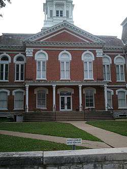
Town Square in Fayette | |
 Location in the state of Missouri | |
| Coordinates: 39°8′44″N 92°41′10″W / 39.14556°N 92.68611°WCoordinates: 39°8′44″N 92°41′10″W / 39.14556°N 92.68611°W | |
| Country | United States |
| State | Missouri |
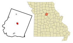
| County | Howard |
| Founded | 1823 |
| Government | |
| • Mayor | Kenneth O'Brian |
| • Administrator | Robin Triplett |
| Area[1] | |
| • Total | 2.26 sq mi (5.85 km2) |
| • Land | 2.22 sq mi (5.75 km2) |
| • Water | 0.04 sq mi (0.10 km2) |
| Elevation | 699 ft (213 m) |
| Population (2010)[2] | |
| • Total | 2,688 |
| • Estimate (2012[3]) | 2,709 |
| • Density | 1,210.8/sq mi (467.5/km2) |
| Time zone | CST (UTC-6) |
| • Summer (DST) | CDT (UTC-5) |
| ZIP code | 65248 |
| Area code(s) | 660 |
| FIPS code | 29-23842[4] |
| GNIS feature ID | 0717869[5] |
| Website | http://fayette.missouri.org/ |
Fayette is a city in Howard County, Missouri, United States. The population was 2,688 at the 2010 census. It is the county seat of Howard County.[6] It is part of the Columbia, Missouri Metropolitan Statistical Area.
History
Fayette was laid out in 1823.[7] The community was named after Gilbert du Motier, Marquis de Lafayette.[8] A post office has been in operation at Fayette since 1824.[9]
Geography
Fayette is at 39°8′44″N 92°41′10″W / 39.14556°N 92.68611°W (39.145468, -92.686126).[10] According to the United States Census Bureau, the city has a total area of 2.26 square miles (5.85 km2), of which 2.22 square miles (5.75 km2) is land and 0.04 square miles (0.10 km2) is water.[1]
Demographics
| Historical population | |||
|---|---|---|---|
| Census | Pop. | %± | |
| 1860 | 647 | — | |
| 1870 | 815 | 26.0% | |
| 1880 | 1,247 | 53.0% | |
| 1890 | 2,247 | 80.2% | |
| 1900 | 2,717 | 20.9% | |
| 1910 | 2,586 | −4.8% | |
| 1920 | 2,381 | −7.9% | |
| 1930 | 2,630 | 10.5% | |
| 1940 | 2,608 | −0.8% | |
| 1950 | 3,144 | 20.6% | |
| 1960 | 3,294 | 4.8% | |
| 1970 | 3,520 | 6.9% | |
| 1980 | 2,983 | −15.3% | |
| 1990 | 2,888 | −3.2% | |
| 2000 | 2,793 | −3.3% | |
| 2010 | 2,688 | −3.8% | |
| Est. 2015 | 2,702 | [11] | 0.5% |
2010 census
As of the census[2] of 2010, there were 2,688 people, 949 households, and 509 families residing in the city. The population density was 1,210.8 inhabitants per square mile (467.5/km2). There were 1,097 housing units at an average density of 494.1 per square mile (190.8/km2). The racial makeup of the city was 83.5% White, 13.0% African American, 0.3% Native American, 0.5% Asian, 0.1% Pacific Islander, 0.6% from other races, and 2.1% from two or more races. Hispanic or Latino of any race were 2.2% of the population.
There were 949 households of which 25.7% had children under the age of 18 living with them, 36.9% were married couples living together, 12.6% had a female householder with no husband present, 4.1% had a male householder with no wife present, and 46.4% were non-families. 37.0% of all households were made up of individuals and 17.5% had someone living alone who was 65 years of age or older. The average household size was 2.17 and the average family size was 2.85.
The median age in the city was 26.1 years. 16.7% of residents were under the age of 18; 32% were between the ages of 18 and 24; 15.9% were from 25 to 44; 19.5% were from 45 to 64; and 15.8% were 65 years of age or older. The gender makeup of the city was 48.7% male and 51.3% female.
2000 census
As of the census[4] of 2000, there were 2,793 people, 976 households, and 578 families residing in the city. The population density was 1,253.6 people per square mile (483.6/km²). There were 1,133 housing units at an average density of 508.5 per square mile (196.2/km²). The racial makeup of the city was 79.16% White, 18.33% African American, 0.47% Native American, 0.21% Asian, 0.04% Pacific Islander, 0.47% from other races, and 1.32% from two or more races. Hispanic or Latino of any race were 0.93% of the population.
There were 976 households out of which 25.0% had children under the age of 18 living with them, 41.4% were married couples living together, 14.5% had a female householder with no husband present, and 40.7% were non-families. 34.5% of all households were individuals and 16.5% had someone living alone who was 65 years of age or older. The average household size was 2.18 and the average family size was 2.79.
In the city the population was spread out with 17.9% under the age of 18, 28.2% from 18 to 24, 19.5% from 25 to 44, 16.2% from 45 to 64, and 18.1% who were 65 years of age or older. The median age was 29 years. For every 100 females there were 91.0 males. For every 100 females age 18 and over, there were 89.3 males.
The median income for a household in the city was $27,276, and the median income for a family was $35,694. Males had a median income of $27,768 versus $20,833 for females. The per capita income for the city was $13,451. About 9.1% of families and 15.6% of the population were below the poverty line, including 18.1% of those under age 18 and 20.0% of those age 65 or over.
Education
Fayette is home to Central Methodist University, a private 4-year university, which is accredited by the North Central Association of Colleges and Schools. It was also home to the now-defunct Howard-Payne Junior College.
In its public school system, Fayette has one elementary school (L. J. Daly), one middle school (W. N. Clark) and one high school (Fayette).
References
- 1 2 "US Gazetteer files 2010". United States Census Bureau. Archived from the original on January 24, 2012. Retrieved 2012-07-08.
- 1 2 "American FactFinder". United States Census Bureau. Retrieved 2012-07-08.
- ↑ "Population Estimates". United States Census Bureau. Archived from the original on June 17, 2013. Retrieved 2013-05-30.
- 1 2 "American FactFinder". United States Census Bureau. Retrieved 2008-01-31.
- ↑ "US Board on Geographic Names". United States Geological Survey. 2007-10-25. Retrieved 2008-01-31.
- ↑ "Find a County". National Association of Counties. Archived from the original on May 10, 2015. Retrieved 2011-06-07.
- ↑ "Post Offices". Jim Forte Postal History. Retrieved 8 October 2016.
- ↑ Eaton, David Wolfe (1916). How Missouri Counties, Towns and Streams Were Named. The State Historical Society of Missouri. p. 174.
- ↑ "Howard County Place Names, 1928–1945 (archived)". The State Historical Society of Missouri. Retrieved 8 October 2016.
- ↑ "US Gazetteer files: 2010, 2000, and 1990". United States Census Bureau. 2011-02-12. Retrieved 2011-04-23.
- ↑ "Annual Estimates of the Resident Population for Incorporated Places: April 1, 2010 to July 1, 2015". Retrieved July 2, 2016.
- ↑ "Census of Population and Housing". Census.gov. Archived from the original on May 11, 2015. Retrieved June 4, 2015.
External links
- Historic maps of Fayette in the Sanborn Maps of Missouri Collection at the University of Missouri
Municipalities and communities of Howard County, Missouri, United States | ||
|---|---|---|
| Cities | 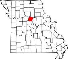 | |
| Townships | ||
| Unincorporated> communities | ||
| Ghost town | ||
| Footnotes | ‡This populated place also has portions in an adjacent county or counties | |