Blackey, Kentucky
| Blackey, Kentucky | |
|---|---|
| City | |
|
Disused railroad sign, Blackey, Kentucky | |
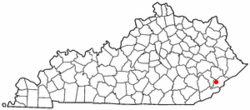 Location of Blackey, Kentucky | |
| Coordinates: 37°8′25″N 82°58′46″W / 37.14028°N 82.97944°WCoordinates: 37°8′25″N 82°58′46″W / 37.14028°N 82.97944°W | |
| Country | United States |
| State | Kentucky |
| County | Letcher |
| Incorporated | January 27, 1915 |
| Government | |
| • Type | Mayor-Council |
| • Mayor | Cathy Back |
| Area | |
| • Total | 0.5 sq mi (1.3 km2) |
| • Land | 0.5 sq mi (1.3 km2) |
| • Water | 0.0 sq mi (0.0 km2) |
| Elevation | 1,007 ft (307 m) |
| Population (2000) | |
| • Total | 153 |
| • Density | 314.6/sq mi (121.5/km2) |
| Time zone | Eastern (EST) (UTC-5) |
| • Summer (DST) | EDT (UTC-4) |
| ZIP code | 41804 |
| Area code(s) | 606 |
| FIPS code | 21-07012 |
| GNIS feature ID | 0507346 |

Blackey is a 6th-class city in Letcher County, Kentucky, in the United States. As of the 2000 census, the population was 153. It is located near the early settlement of Indian Bottom. Blackey is thought to have been named after Blackey Brown, one of its citizens.[1]
History
The history of Blackey began in 1908, after local resident, Jim Brown, was given permission to establish a post office on Elk Creek. He decided to name the post office "Blackey", after his brother Joseph "Blackey" Brown. Due to the areas massive coal deposits, the Lexington and Eastern Railroad ran a line through Blackey in November 1912. Over the next fifteen years, Blackey was transformed from a sleepy mountain town to a bustling modern city. It was chartered in November 1912 and was incorporated on January 27, 1915.[2] In 1913, the community became the home of the Stuart Robinson School, a Presbyterian settlement school that was to operate there until 1957.[3] In 1917, the Blackey Coal Company was established as the first coal company in Blackey. The company constructed thirty houses and employed eighty miners.[2]
In May 1927, a flash flood devastated the city. In one hour, the North Fork of the Kentucky River rose eighteen feet, killing 26 people in Letcher County alone. Later in December a fire broke out destroying most of the city's business district. Then in February 1928, another fire broke out and destroyed the rest of the town. Shortly afterwards, Blackey State Bank failed and the Great Depression ended the prosperity of the boom town.[2]
Today, Blackey is home to just over one-hundred fifty people, with only a few abandoned buildings and a few occupied homes on Main Street. But, within the last few years, the city has seen some revitalization consisting of a Head Start, a new city water system, and a public library.[2]
A light 4.3 magnitude earthquake rattled southeastern Kentucky on Saturday, November 10, 2012, at 12:08 p.m. ET (1708 GMT), the U.S. Geological Survey reported. The quake, at a shallow depth of 0.7 mile (1.1 km), was in the Appalachian Mountains near the Virginia border, and centered in the rural town of Blackey, the agency said.[4]
Culture
The Old Regular Baptist church is strong in Blackey, and the Indian Bottom Old Regular Baptist Church is located here. Just across a small bridge is the C. B. Caudill Store & History Center, operated by Gaynell Begley. It was formerly a general store but has been converted into a history and community center.[5]
Geography
Blackey is located at 37°8′25″N 82°58′46″W / 37.14028°N 82.97944°W (37.140413, -82.979368).[6]
According to the United States Census Bureau, the city has a total area of 0.5 square miles (1.3 km2), all land.
Demographics
| Historical population | |||
|---|---|---|---|
| Census | Pop. | %± | |
| 1920 | 269 | — | |
| 1930 | 349 | 29.7% | |
| 1940 | 545 | 56.2% | |
| 1950 | 393 | −27.9% | |
| 2000 | 153 | — | |
| 2010 | 120 | −21.6% | |
| Est. 2015 | 158 | [7] | 31.7% |
As of the census[9] of 2000, there were 153 people, 65 households, and 49 families residing in the city. The population density was 314.6 people per square mile (120.6/km²). There were 73 housing units at an average density of 150.1 per square mile (57.5/km²). The racial makeup of the city was 98.69% White and 1.31% from two or more races.
There were 65 households out of which 23.1% had children under the age of 18 living with them, 60.0% were married couples living together, 10.8% had a female householder with no husband present, and 23.1% were non-families. 21.5% of all households were made up of individuals and 6.2% had someone living alone who was 65 years of age or older. The average household size was 2.35 and the average family size was 2.66.
In the city the population was spread out with 17.0% under the age of 18, 11.8% from 18 to 24, 24.8% from 25 to 44, 34.0% from 45 to 64, and 12.4% who were 65 years of age or older. The median age was 42 years. For every 100 females there were 86.6 males. For every 100 females age 18 and over, there were 95.4 males.
The median income for a household in the city was $19,250, and the median income for a family was $20,625. Males had a median income of $30,536 versus $21,875 for females. The per capita income for the city was $11,278. About 22.9% of families and 24.3% of the population were below the poverty line, including 28.1% of those under the age of eighteen and 33.3% of those sixty five or over.
References
- ↑ Blackey, Kentucky, Kentucky Atlas. Retrieved 18 May 2006.
- 1 2 3 4 History of Blackey, Kentucky Retrieved on 2010-04-10
- ↑ Helen Wykle (October 28, 2008), "Stuart Robinson School", Settlement Schools of the Southern Mountains, D.H. Ramsey Library, Special Collections, University of North Carolina Asheville
- ↑ "Blackey, Kentucky Earthquake Rattles Appalachian Mountains Near Virginia Border", Huff Post Green, Nov. 10, 2012. Retrieved December 7, 2012.
- ↑ C.B. Caudill Store and History Center Retrieved on 2010-04-10
- ↑ "US Gazetteer files: 2010, 2000, and 1990". United States Census Bureau. 2011-02-12. Retrieved 2011-04-23.
- ↑ "Annual Estimates of the Resident Population for Incorporated Places: April 1, 2010 to July 1, 2015". Retrieved July 2, 2016.
- ↑ "Census of Population and Housing". Census.gov. Archived from the original on May 11, 2015. Retrieved June 4, 2015.
- ↑ "American FactFinder". United States Census Bureau. Archived from the original on 2013-09-11. Retrieved 2008-01-31.
External links
- Blackey page, from Appalshop site
- C. B. Caudill Store & History Center, from Appalshop site
Municipalities and communities of Letcher County, Kentucky, United States | ||
|---|---|---|
| Cities | 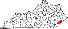 | |
| CDPs |
| |
| Unincorporated communities | ||
| Ghost towns | ||
