Letcher County, Kentucky
| Letcher County, Kentucky | |
|---|---|
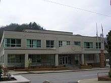 Letcher County courthouse in Whitesburg | |
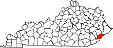 Location in the U.S. state of Kentucky | |
 Kentucky's location in the U.S. | |
| Founded | 1842 |
| Named for | Robert P. Letcher |
| Seat | Whitesburg |
| Largest city | Jenkins |
| Area | |
| • Total | 339 sq mi (878 km2) |
| • Land | 338 sq mi (875 km2) |
| • Water | 1.1 sq mi (3 km2), 0.3% |
| Population | |
| • (2010) | 24,519 |
| • Density | 73/sq mi (28/km²) |
| Congressional district | 5th |
| Time zone | Eastern: UTC-5/-4 |
| Website |
letchercounty |
Letcher County is a county located in the U.S. state of Kentucky. As of the 2010 census, the population was 24,519.[1] Its county seat is Whitesburg.[2][3] The county, founded in 1842, is named for Robert P. Letcher, Governor of Kentucky from 1840-1844.[4][5][6]
Letcher County is a dry county, with the only exceptions being the Highland Winery,[7] the city of Whitesburg, and the city of Jenkins.
The killing of filmmaker Hugh O'Connor by a local landowner in 1967 brought Letcher County to national attention.
Geography
According to the U.S. Census Bureau, the county has a total area of 339 square miles (880 km2), of which 338 square miles (880 km2) is land and 1.1 square miles (2.8 km2) (0.3%) is water.[8] Letcher County's natural areas include Bad Branch Falls and the Lilley Cornett Woods.
Adjacent counties
- Knott County (northwest)
- Pike County (northeast)
- Wise County, Virginia (southeast)
- Harlan County (south)
- Perry County (southwest)
National protected area
- Jefferson National Forest (part)
Pioneer Horse Trail controversy
.jpg)
In an effort to bring tourists to Letcher County and to revitalize the local economy, the Pioneer Horse Trail is currently under construction on Pine Mountain.[9] The trail, part of an "adventure tourism" initiative spearheaded by Governor Steve Beshear, Beshear's wife Jane, and Lieutenant Governor Daniel Mongiardo, is scheduled for completion in the spring of 2009.[9]
However, controversy has arisen about whether or not the environment would be harmed during construction. In the summer of 2008, the Letcher County Fiscal Court had signed an agreement with state officials stating that the county would do an environmental impact study before construction would begin.[9] Documents obtained by the Lexington Herald-Leader under Kentucky's Open Records Act showed that construction actually began before the study was to take place. County-owned bulldozers started clearing trees in part of a wildlife management area in which heavy equipment was not permitted.[9] Environmental groups are asking the U.S. Fish and Wildlife Service to determine if any species on the threatened or endangered list were harmed.[9] Because of the environmental impact studies, construction has been halted for the time being.[10]
Demographics
| Historical population | |||
|---|---|---|---|
| Census | Pop. | %± | |
| 1850 | 2,512 | — | |
| 1860 | 3,904 | 55.4% | |
| 1870 | 4,608 | 18.0% | |
| 1880 | 6,601 | 43.3% | |
| 1890 | 6,920 | 4.8% | |
| 1900 | 9,172 | 32.5% | |
| 1910 | 10,623 | 15.8% | |
| 1920 | 24,467 | 130.3% | |
| 1930 | 35,702 | 45.9% | |
| 1940 | 40,592 | 13.7% | |
| 1950 | 39,522 | −2.6% | |
| 1960 | 30,102 | −23.8% | |
| 1970 | 23,165 | −23.0% | |
| 1980 | 30,687 | 32.5% | |
| 1990 | 27,000 | −12.0% | |
| 2000 | 25,277 | −6.4% | |
| 2010 | 24,519 | −3.0% | |
| Est. 2015 | 23,123 | [11] | −5.7% |
| U.S. Decennial Census[12] 1790-1960[13] 1900-1990[14] 1990-2000[15] 2010-2013[1] | |||
As of the census[16] of 2000, there were 25,277 people, 10,085 households, and 7,462 families residing in the county. The population density was 75 per square mile (29/km2). There were 11,405 housing units at an average density of 34 per square mile (13/km2). The racial makeup of the county was 98.71% White, 0.51% Black or African American, 0.10% Native American, 0.28% Asian, 0.02% Pacific Islander, 0.03% from other races, and 0.35% from two or more races. 0.44% of the population were Hispanic or Latino of any race.
There were 10,085 households out of which 32.30% had children under the age of 18 living with them, 58.40% were married couples living together, 11.50% had a female householder with no husband present, and 26.00% were non-families. 24.10% of all households were made up of individuals and 10.10% had someone living alone who was 65 years of age or older. The average household size was 2.48 and the average family size was 2.94.
The age distribution was 23.70% under the age of 18, 9.20% from 18 to 24, 28.70% from 25 to 44, 25.80% from 45 to 64, and 12.60% who were 65 years of age or older. The median age was 38 years. For every 100 females there were 95.80 males. For every 100 females age 18 and over, there were 92.10 males.
The median income for a household in the county was $21,110, and the median income for a family was $24,869. Males had a median income of $30,488 versus $17,902 for females. The per capita income for the county was $11,984. About 23.70% of families and 27.10% of the population were below the poverty line, including 35.90% of those under age 18 and 21.20% of those age 65 or over.
Education
Two public school districts operate in the county.
Letcher County Public Schools
Most K-12 students in the county, with the exception of those living in the far eastern part of the county surrounding Jenkins, are served by the Letcher County Public Schools. The district operates nine elementary/middle schools, one vocational school, one high school, and an alternative education center.
In 2005, the doors to the new Letcher County Central High School[17] were opened in Ermine (the school's postal address, however, is in Whitesburg), with total costs of over $25,000,000. The school's nickname is the Cougars, and the school colors are blue, black, and silver. The school volleyball team has been to the state tournament every year since its creation and the wrestling team has had multiple regional champions. The baseball team has claimed three region titles in 2007, 2011, and 2013, with two state tournament appearances and one semi-state appearance. The baseball team has been led by the 14th region coach of the year, Bryan Dean, since its creation.[18] The boys Cross Country team has had 3 region championships and an individual region champion. The Girls basketball team made a State sweet sixteen appearance.[19]
Jenkins Independent Schools
Students in the Jenkins area are served by the Jenkins Independent Schools, which operates two elementary schools (located on two campuses in the communities of McRoberts and Burdine[20]) and a combined middle and high school with grades 7-12. Jenkins Independent Schools will be entering its 100th year in 2012. The middle/high school's athletic nickname is the Cavaliers/Lady Cavaliers. The school colors are Kelly Green and White.
Politics
| Year | Republican | Democratic |
|---|---|---|
| 2016 | 79.8% 7,293 | 16.9% 1,542 |
| 2012 | 77.8% 6,811 | 19.4% 1,702 |
| 2008 | 65.2% 5,367 | 31.9% 2,623 |
| 2004 | 53.0% 4,801 | 46.2% 4,192 |
| 2000 | 45.5% 4,092 | 52.3% 4,698 |
| 1996 | 30.8% 2,222 | 57.6% 4,160 |
| 1992 | 29.8% 3,011 | 57.7% 5,817 |
| 1988 | 43.2% 3,601 | 56.3% 4,697 |
| 1984 | 46.1% 4,073 | 53.3% 4,707 |
| 1980 | 43.8% 3,426 | 54.7% 4,280 |
| 1976 | 40.3% 3,122 | 59.2% 4,590 |
| 1972 | 58.5% 4,213 | 40.4% 2,908 |
| 1968 | 42.3% 3,243 | 45.6% 3,499 |
| 1964 | 32.6% 2,632 | 67.2% 5,420 |
| 1960 | 50.9% 4,408 | 49.1% 4,258 |
For most of the late 20th century Letcher county was a reliable Democratic county. However, since 2004 it has now become a solidly Republican county.
Economy
Coal companies in Letcher County
- Alpha Natural Resources[22]
- James River Coal Company[23]
- Rhino Resource Partners[24]
- United Coal Company[25]
Media
Television
There are two Public-access television cable TV channels that serve Letcher County. The Letcher County Government Channel is Government-access television (GATV), operated by the Letcher County Fiscal Court and airs government meetings, local events, and emergency information.[26] LCPS-TV is operated by the Letcher County Public Schools and airs school announcements, events, and Educational access television programs.[27]
Radio
Newspapers
- The Mountain Eagle
- Letcher County Community News-Press
Infrastructure
Transportation
Public transportation is provided by LKLP Community Action Partnership with demand-response service and scheduled service from Whitesburg to Hazard.[28]
Events
- Whitesburg's July 4th Celebration, is a free event held on the Fourth of July at Parkway Plaza shopping center. The event includes free music, entertainment, fireworks and fun.
- In Whitesburg: Riverside Days, a three-day annual festival held at Riverside Park.
- Whitesburg Labor Day Celebration, a one-day festival held in Riverside Park on Labor Day Monday. It features food, as well as free music, entertainment and inflatables for the kids.
- The town of Fleming-Neon, hosts its annual Neon Area Days the second Friday and Saturday in September. Neon is home to gospel singer Martha Carson. In 1998 she returned to Neon for the festival and was honored.
- The Mountain Heritage Festival is held during the last full week of September.
- In Jenkins, Jenkins Homecoming Days are also celebrated annually in August.
- The Heritage 2KX Minitruck Show, the largest Modern Customs show in the state of Kentucky, is held every weekend after Labor Day and is one of the largest three events in the county every year. Several thousand spectators travel from all across the Eastern United States to attend this national event.
Communities
Notable people
- Harry M. Caudill (1922–1990), author, historian, professor, lawyer, legislator, and environmentalist
- Emery L. Frazier (Mayor, state representative, Chief Clerk of the U.S. Senate, Secretary of the U.S. Senate, 1896–1973)
- Gary Stewart (Country music singer and musician, 1944–2003)
- Martha Carson (Country/gospel music singer, 1920–2004)
- Lee Sexton (Country, bluegrass, old-time musician)
- Tom Gish, died 2008, publisher of the Mountain Eagle in Whitesburg, grew up in the county
- Francis Gary Powers (August 17, 1929 – August 1, 1977) was an American pilot whose CIA U-2 spy plane was shot down while over the Soviet Union, causing the 1960 U-2 incident.
See also
- Caudill, Harry M., Author of Night Comes to the Cumberlands (1963). ISBN 0-316-13212-8
- National Register of Historic Places listings in Letcher County, Kentucky
References
- 1 2 "State & County QuickFacts". United States Census Bureau. Retrieved March 6, 2014.
- ↑ "Find a County". National Association of Counties. Archived from the original on May 31, 2011. Retrieved 2011-06-07.
- ↑ "Populations of Kentucky (KY) Cities - Alphabetical Listing of Cities - page 2". Togetherweteach.com. Retrieved June 4, 2013.
- ↑ "Letcher County". Kyenc.org. May 30, 1927. Retrieved June 4, 2013.
- ↑ The Register of the Kentucky State Historical Society, Volume 1. Kentucky State Historical Society. 1903. p. 36.
- ↑ Collins, Lewis (1877). History of Kentucky. p. 463.
- ↑ "Wet & Dry Counties in Kentucky" (PDF). Kentucky Office of Alcoholic Beverage Control. 2005-08-19. Archived from the original (PDF) on 2007-03-15. Retrieved 2007-03-17.
- ↑ "2010 Census Gazetteer Files". United States Census Bureau. August 22, 2012. Retrieved August 17, 2014.
- 1 2 3 4 5 Mead, Andy (2008-12-26). "Horse trail in trouble from start". Lexington Herald-Leader. Retrieved 2008-12-26.
- ↑ "Environmental Group Asks For Investigation". WYMT-TV. 2008-12-26. Retrieved 2008-12-27.
- ↑ "County Totals Dataset: Population, Population Change and Estimated Components of Population Change: April 1, 2010 to July 1, 2015". Retrieved July 2, 2016.
- ↑ "U.S. Decennial Census". United States Census Bureau. Archived from the original on May 11, 2015. Retrieved August 17, 2014.
- ↑ "Historical Census Browser". University of Virginia Library. Retrieved August 17, 2014.
- ↑ "Population of Counties by Decennial Census: 1900 to 1990". United States Census Bureau. Retrieved August 17, 2014.
- ↑ "Census 2000 PHC-T-4. Ranking Tables for Counties: 1990 and 2000" (PDF). United States Census Bureau. Retrieved August 17, 2014.
- ↑ "American FactFinder". United States Census Bureau. Archived from the original on September 11, 2013. Retrieved 2008-01-31.
- ↑ http://www.letcher.k12.ky.us/ Letcher County Central High School
- ↑ "Letcher County Central 2011 Kentucky High School Baseball". Scoreboard.12dt.com. Retrieved June 4, 2013.
- ↑ http://www.khsaa.org
- ↑ Jenkins Elementary School Retrieved on December 21, 2008.
- ↑ http://uselectionatlas.org/RESULTS/
- ↑ [Alpha Natural Resources - 2012 Kentucky Operations]
- ↑ James River Coal Company – Blue Diamond complex
- ↑ Rhino Resource Partners - Central Appalachia
- ↑ METINVEST :: What we do :: Our facilities:
- ↑ Conroy, Marcus (4 July 2010). "Local County Channel becoming popular". WYMT-TV. Retrieved 4 July 2010.
- ↑ "LCPS-TV Information". Letcher County Public Schools. Retrieved 4 July 2010.
- ↑ "LKLP Community Action Council, Inc. > Programs > Public Transportation". Retrieved 2015-05-19.
Further reading
- Blackford, Linda B. (December 14, 2013). "Schools improving in Eastern Kentucky, but progress 'painfully slow'". Lexington Herald-Leader.
External links
- Official Letcher County government website
- Official Letcher County Tourism site
- Letcher County Public Schools
- Jenkins Independent Schools
- Letcher County Library District
- The Kentucky Highlands Project
- Riverside Days Festival - Whitesburg, Kentucky
- Letcher County genealogy
- Heritage 2KX Minitruck Show
- National Geographic Magazine (ZipUSA article)
- Letcher County: Head of Three Rivers Water Quality Project
- Letcher County Central High School
- Letcher County Area Technology Center
- Whitesburg Weather
- Whitesburg Masonic Lodge # 754
- Letcher County Chamber of Commerce
Municipalities and communities of Letcher County, Kentucky, United States | ||
|---|---|---|
| Cities | | |
| CDPs |
| |
| Unincorporated communities | ||
| Ghost towns | ||

Coordinates: 37°07′N 82°51′W / 37.12°N 82.85°W