Steelville, Missouri
| Steelville, Missouri | |
|---|---|
| City | |
|
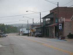
Downtown Steelville | |
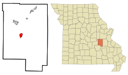 Location of Steelville, Missouri | |
| Coordinates: 37°58′7″N 91°21′19″W / 37.96861°N 91.35528°WCoordinates: 37°58′7″N 91°21′19″W / 37.96861°N 91.35528°W | |
| Country | United States |
| State | Missouri |
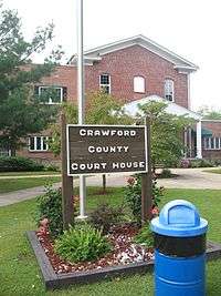
| County | Crawford |
| Area[1] | |
| • Total | 2.42 sq mi (6.27 km2) |
| • Land | 2.42 sq mi (6.27 km2) |
| • Water | 0 sq mi (0 km2) |
| Elevation | 748 ft (228 m) |
| Population (2010)[2] | |
| • Total | 1,642 |
| • Estimate (2012[3]) | 1,683 |
| • Density | 678.5/sq mi (262.0/km2) |
| Time zone | Central (CST) (UTC-6) |
| • Summer (DST) | CDT (UTC-5) |
| ZIP code | 65565 |
| Area code(s) | 573 |
| FIPS code | 29-70576[4] |
| GNIS feature ID | 0752345[5] |
Steelville is a city in Crawford County, Missouri, United States. The population was 1,642 at the 2010 census. It is the county seat of Crawford County.[6] It was the hometown of Congressman Albert Reeves. Also to Missouri State Representative Jason Chipman. The town was named after landowner James Steel.
History
Prior to the 1800s the first people to live in the Steelville area were groups likely tied to the Osage. These peoples were driven west into what is today Oklahoma. In the 1840s the Trail of Tears, a government sponsored forced-march of the largest groups of the southeastern United States, passed through Steelville, with people primarily from the Choctaw and Cherokee tribes. They came mostly from Georgia, Alabama, Kentucky, and Tennessee and were forced to relocate to Oklahoma and the West. It is believed that they stopped in Steelville around the spring to rest, bury their dead, and get supplies.
The first settlers in Steelville were William Britton, who built a small grist mill along the Yadkin Creek, and James Steel, who operated a trading post and was appointed by the government as Commissioner to lay out the city in 1835–the year in which Steelville was founded. Britton remained in the area. Steel, according to census, moved northward to continue his interest in mining.
James Steel purchased 40 acres of land from the government which he later sold to the “County Court” on December 16, 1835 for $50.[7] By this time a little settlement had sprung up. Crawford County Court named the town Steelville as the County Seat. The deed was recorded on December 18, 1835, the town was platted, and the first deeds to lots were sold for $12 each.
The town was incorporated as a city of the fourth class in 1885. At this time, there were 500 inhabitants. The Lebanon Lodge, Masonic, was chartered on October 14, 1846. The first tailor, Mr. Vanburg, came in town in 1844. The first hotel was owned by James Davis. In 1847, A. W. Johnson opened a blacksmith shop. Andrew Jackson opened the first Post Office. Doctor Dunlap was the first doctor, and in 1838, J. H. Johnson opened the first saddle and harness shop.
The Steelville Normal Business Institute was originally at Vichy, Missouri. It was moved to Steelville with the help of John T. Woodruff of Springfield and Professor Hayes and opened during the latter part of 1890.
The first Newspaper of Steelville, Steelville Crawford Missouri, was established on May 4, 1874, by Thomas Roberts. The paper was printed in a log cabin the first time and was a Republican paper.
The Steelville Bank began operations in October, 1884, under the direction of President G. W. Matlock. This was constructed of brick and was very strong by the standards of that time. Later, the bank was named Crawford County Farmers Bank. In 1925, bank robbers made an attempt to rob the bank. Most of the robbers were killed. Robbers included Basil Doman, age 21, from Mitchell, Illinois. McCellan was wounded and died after being examined. Albert Walters, age 20, from Granite City, Illinois, was the driver of the getaway car and was shot. The youngest, Leslie Reiter, age 16, from Madison, Illinois, was sent to jail. One robber was dead, two were wounded, one was taken prisoner, and a fifth got away. He was never caught or identified. The sheriff at the time was Mr. Enke. There was only one citizen wounded – A. D. Schwieder – who was walking out of the adjoining store and was shot in the leg after a shoot out with one of the robbers, whom he killed.
Geography
Steelville is located at 37°58′7″N 91°21′19″W / 37.96861°N 91.35528°W (37.968509, -91.355163).[8] According to the United States Census Bureau, the city has a total area of 2.42 square miles (6.27 km2), all of it land.[1]
Demographics
| Historical population | |||
|---|---|---|---|
| Census | Pop. | %± | |
| 1860 | 226 | — | |
| 1870 | 232 | 2.7% | |
| 1880 | 410 | 76.7% | |
| 1890 | 591 | 44.1% | |
| 1900 | 686 | 16.1% | |
| 1910 | 773 | 12.7% | |
| 1920 | 767 | −0.8% | |
| 1930 | 854 | 11.3% | |
| 1940 | 1,013 | 18.6% | |
| 1950 | 1,157 | 14.2% | |
| 1960 | 1,127 | −2.6% | |
| 1970 | 1,392 | 23.5% | |
| 1980 | 1,470 | 5.6% | |
| 1990 | 1,465 | −0.3% | |
| 2000 | 1,429 | −2.5% | |
| 2010 | 1,642 | 14.9% | |
| Est. 2015 | 1,699 | [9] | 3.5% |
2010 census
As of the census[2] of 2010, there were 1,642 people, 638 households, and 345 families residing in the city. The population density was 678.5 inhabitants per square mile (262.0/km2). There were 753 housing units at an average density of 311.2 per square mile (120.2/km2). The racial makeup of the city was 96.10% White, 0.97% Black or African American, 1.16% Native American, 0.43% Asian, 0.55% from other races, and 0.79% from two or more races. Hispanic or Latino of any race were 1.77% of the population.
There were 638 households of which 32.8% had children under the age of 18 living with them, 34.0% were married couples living together, 13.6% had a female householder with no husband present, 6.4% had a male householder with no wife present, and 45.9% were non-families. 37.6% of all households were made up of individuals and 19.1% had someone living alone who was 65 years of age or older. The average household size was 2.35 and the average family size was 3.12.
The median age in the city was 36.8 years. 24.2% of residents were under the age of 18; 9.1% were between the ages of 18 and 24; 26.4% were from 25 to 44; 21.1% were from 45 to 64; and 19.2% were 65 years of age or older. The gender makeup of the city was 47.3% male and 52.7% female.
2000 census
As of the census[4] of 2000, there were 1,429 people, 616 households, and 349 families residing in the city. The population density was 548.8 people per square mile (212.2/km²). There were 724 housing units at an average density of 278.0 per square mile (107.5/km²). The racial makeup of the city was 99.09% White, 0.14% Native American, 0.42% Pacific Islander, 0.07% from other races, and 0.28% from two or more races. Hispanic or Latino of any race were 0.07% of the population.
There were 616 households out of which 25.8% had children under the age of 18 living with them, 41.2% were married couples living together, 13.6% had a female householder with no husband present, and 43.3% were non-families. 37.3% of all households were made up of individuals and 20.8% had someone living alone who was 65 years of age or older. The average household size was 2.18 and the average family size was 2.88.
In the city the population was spread out with 24.4% under the age of 18, 7.9% from 18 to 24, 24.6% from 25 to 44, 19.4% from 45 to 64, and 23.7% who were 65 years of age or older. The median age was 39 years. For every 100 females there were 74.3 males. For every 100 females age 18 and over, there were 68.2 males.
The median income for a household in the city was $19,596, and the median income for a family was $26,765. Males had a median income of $23,913 versus $16,250 for females. The per capita income for the city was $12,550. About 20.2% of families and 25.5% of the population were below the poverty line, including 36.0% of those under age 18 and 17.0% of those age 65 or over.
Attractions
Steelville is the self-proclaimed "Floating Capital of Missouri". Three rivers navigable by small watercraft are nearby. They are the Meramec, the Huzzah, and the Courtois (pronounced "Cotaway" by the locals). Many businesses in the area of Steelville offer rentals of canoes, rafts, and inner-tubes for float trips along with camping. This brings "tourists" and "floaters" from as far as Tennessee, Arkansas, etc.
References
- 1 2 "US Gazetteer files 2010". United States Census Bureau. Retrieved 2012-07-08.
- 1 2 "American FactFinder". United States Census Bureau. Retrieved 2012-07-08.
- ↑ "Population Estimates". United States Census Bureau. Retrieved 2013-05-30.
- 1 2 "American FactFinder". United States Census Bureau. Retrieved 2008-01-31.
- ↑ "US Board on Geographic Names". United States Geological Survey. 2007-10-25. Retrieved 2008-01-31.
- ↑ "Find a County". National Association of Counties. Retrieved 2011-06-07.
- ↑ Eaton, David Wolfe (1916). How Missouri Counties, Towns and Streams Were Named. The State Historical Society of Missouri. p. 282.
- ↑ "US Gazetteer files: 2010, 2000, and 1990". United States Census Bureau. 2011-02-12. Retrieved 2011-04-23.
- ↑ "Annual Estimates of the Resident Population for Incorporated Places: April 1, 2010 to July 1, 2015". Retrieved July 2, 2016.
- ↑ "Census of Population and Housing". Census.gov. Retrieved June 4, 2015.
External links
- Historic maps of Steelville in the Sanborn Maps of Missouri Collection at the University of Missouri
Municipalities and communities of Crawford County, Missouri, United States | ||
|---|---|---|
| Cities | 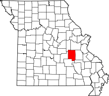 | |
| Villages | ||
| Townships | ||
| Unincorporated communities | ||
| Ghost towns | ||
| Footnotes | ‡This populated place also has portions in an adjacent county or counties | |