McLean County, Kentucky
| McLean County, Kentucky | |
|---|---|
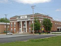 McLean County Courthouse in Calhoun | |
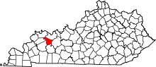 Location in the U.S. state of Kentucky | |
 Kentucky's location in the U.S. | |
| Founded | 1854 |
| Named for | Alney McLean |
| Seat | Calhoun |
| Largest city | Livermore |
| Area | |
| • Total | 256 sq mi (663 km2) |
| • Land | 252 sq mi (653 km2) |
| • Water | 3.8 sq mi (10 km2), 1.5% |
| Population | |
| • (2010) | 9,531 |
| • Density | 38/sq mi (15/km²) |
| Congressional district | 1st |
| Time zone | Central: UTC-6/-5 |
| Website |
www |
McLean County (/məˈkleɪn/) is a county located in the U.S. state of Kentucky. As of the 2010 census, the population was 9,531.[1] Its county seat is Calhoun.[2] McLean is a prohibition or dry county.
McLean County is part of the Owensboro, KY Metropolitan Statistical Area, which has a population of some 114,752 (2010 census).
History
McLean County was formed by act of the Kentucky legislature on February 6, 1854 from portions of surrounding Daviess, Ohio, and Muhlenberg Counties. The county was named for Judge Alney McLean, founder of Greenville, the county seat of Muhlenberg County.[3][4]
Geography
According to the U.S. Census Bureau, the county has a total area of 256 square miles (660 km2), of which 252 square miles (650 km2) is land and 3.8 square miles (9.8 km2) (1.5%) is water.[5]
Features
McLean County is part of the Western Coal Fields region of Kentucky.
The county is transected southeast to northwest by Green River, the longest river entirely within the Commonwealth of Kentucky. Bridge crossings of Green River are at Calhoun, Livermore and west of Beech Grove. Green River is navigable throughout McLean County, with Army Corps of Engineers Lock and Dam #2 at Calhoun assisting boat navigation.
Adjacent counties
- Henderson County (northwest)
- Daviess County (northeast)
- Ohio County (east)
- Muhlenberg County (south)
- Hopkins County (southwest)
- Webster County (west)
Demographics
| Historical population | |||
|---|---|---|---|
| Census | Pop. | %± | |
| 1860 | 6,144 | — | |
| 1870 | 7,614 | 23.9% | |
| 1880 | 9,293 | 22.1% | |
| 1890 | 9,887 | 6.4% | |
| 1900 | 12,448 | 25.9% | |
| 1910 | 13,241 | 6.4% | |
| 1920 | 12,502 | −5.6% | |
| 1930 | 11,072 | −11.4% | |
| 1940 | 11,446 | 3.4% | |
| 1950 | 10,021 | −12.4% | |
| 1960 | 9,355 | −6.6% | |
| 1970 | 9,062 | −3.1% | |
| 1980 | 10,090 | 11.3% | |
| 1990 | 9,628 | −4.6% | |
| 2000 | 9,938 | 3.2% | |
| 2010 | 9,531 | −4.1% | |
| Est. 2015 | 9,512 | [6] | −0.2% |
| U.S. Decennial Census[7] 1790-1960[8] 1900-1990[9] 1990-2000[10] 2010-2013[1] | |||
As of the census[11] of 2000, there were 9,938 people, 3,984 households, and 2,880 families residing in the county. The population density was 39 per square mile (15/km2). There were 4,392 housing units at an average density of 17 per square mile (6.6/km2). The racial makeup of the county was 98.58% White, 0.36% Black or African American, 0.16% Native American, 0.04% Asian, 0.01% Pacific Islander, 0.31% from other races, and 0.53% from two or more races. 0.84% of the population were Hispanic or Latino of any race.
There were 3,984 households out of which 32.30% had children under the age of 18 living with them, 60.00% were married couples living together, 8.70% had a female householder with no husband present, and 27.70% were non-families. 24.70% of all households were made up of individuals and 11.40% had someone living alone who was 65 years of age or older. The average household size was 2.47 and the average family size was 2.93.
In the county the population was spread out with 24.20% under the age of 18, 8.30% from 18 to 24, 27.70% from 25 to 44, 25.40% from 45 to 64, and 14.50% who were 65 years of age or older. The median age was 38 years. For every 100 females there were 96.40 males. For every 100 females age 18 and over, there were 93.20 males.
The median income for a household in the county was $29,675, and the median income for a family was $35,322. Males had a median income of $28,446 versus $19,432 for females. The per capita income for the county was $16,046. About 13.70% of families and 16.00% of the population were below the poverty line, including 21.10% of those under age 18 and 18.50% of those age 65 or over.
Education
McLean County has a county-wide public school district of some 1,700 students with one high school, one middle school and three elementary schools.
McLean County High School has approximately 500 students. McLean County Middle School has roughly 350 students. In the 2006-2007 school year, McLean County Middle School ranked third in final year testing and second in public schools to Hancock County. Both schools are located just east of Calhoun on Highway 136 and have the cougar as mascots.
Additionally, the county school system has three grade K-5 elementary schools in the towns of Calhoun, Livermore and Sacramento. Two additional grade K-5 elementary schools are found in the towns of Beech Grove and Island, but both of them are definitely defunct. The Calhoun and Livermore elementaries have about 300 students each, while Sacramento Elementary has 125 students. Calhoun Elementary School's mascot is the bulldog, Livermore Elementary School's mascot is the yellow jacket, Sacramento Elementary School's mascot is the blue jay, Island Elementary School's mascot was the eagle, and Beech Grove Elementary School's mascot was the gorilla. Sacramento's future was at stake one time, but the school is renamed as Marie Gatton Phillips Elementary School in order to stay active with Calhoun and Livermore and not fall in the defunct zone like how Beech Grove and Island did.
At any time, between 350 and 400 county residents are enrolled in higher education of some form.
Media
McLean County is served by a weekly newspaper, the McLean County News.
Communities
Cities
- Calhoun, population 837, sits on the north bank of Green River in the central area of the county and is the seat of government.
- Island is noted for its annual Wooden Bridge Festival and has a population of 435.
- Livermore, the largest community in McLean County with a population 1,482, lies in the eastern part of the county at the scenic confluence of Rough and Green Rivers. Livermore's bridge is noteworthy, as it begins in McLean County, crosses the Rough River, passes over and has a pylon on a sliver of Ohio County territory, crosses the Green River, then ends back in McLean County.
- Sacramento is home to the annual Battle of Sacramento Civil War Reenactment, the largest tourist event in the county, and has a population of 517.
Unincorporated communities
- Beech Grove
- Buel
- Buttonsberry
- Cleopatra
- Comer
- Congleton
- Elba
- Glenville
- Guffie
- Lemon
- Livia
- Nuckols
- Pack
- Poplar Grove
- Poverty
- Rumsey
- Semiway
- Wrightsburg
- Wyman
See also
Coordinates: 37°32′N 87°16′W / 37.53°N 87.26°W
References
- 1 2 "State & County QuickFacts". United States Census Bureau. Retrieved March 6, 2014.
- ↑ "Find a County". National Association of Counties. Archived from the original on May 31, 2011. Retrieved 2011-06-07.
- ↑ The Register of the Kentucky State Historical Society, Volume 1. Kentucky State Historical Society. 1903. p. 36.
- ↑ Collins, Lewis (1877). History of Kentucky. p. 596.
- ↑ "2010 Census Gazetteer Files". United States Census Bureau. August 22, 2012. Retrieved August 17, 2014.
- ↑ "County Totals Dataset: Population, Population Change and Estimated Components of Population Change: April 1, 2010 to July 1, 2015". Retrieved July 2, 2016.
- ↑ "U.S. Decennial Census". United States Census Bureau. Archived from the original on May 11, 2015. Retrieved August 17, 2014.
- ↑ "Historical Census Browser". University of Virginia Library. Retrieved August 17, 2014.
- ↑ "Population of Counties by Decennial Census: 1900 to 1990". United States Census Bureau. Retrieved August 17, 2014.
- ↑ "Census 2000 PHC-T-4. Ranking Tables for Counties: 1990 and 2000" (PDF). United States Census Bureau. Retrieved August 17, 2014.
- ↑ "American FactFinder". United States Census Bureau. Archived from the original on September 11, 2013. Retrieved 2008-01-31.
Municipalities and communities of McLean County, Kentucky, United States | ||
|---|---|---|
| Cities | | |
| CDP |
| |
| Unincorporated communities | ||
