Monroe County, Kentucky
| Monroe County, Kentucky | |
|---|---|
 Monroe County courthouse in Tompkinsville | |
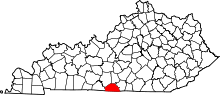 Location in the U.S. state of Kentucky | |
 Kentucky's location in the U.S. | |
| Founded | 1820 |
| Named for | James Monroe |
| Seat | Tompkinsville |
| Largest city | Tompkinsville |
| Area | |
| • Total | 332 sq mi (860 km2) |
| • Land | 329 sq mi (852 km2) |
| • Water | 2.7 sq mi (7 km2), 0.8% |
| Population | |
| • (2010) | 10,963 |
| • Density | 36/sq mi (14/km²) |
| Congressional district | 1st |
| Time zone | Central: UTC-6/-5 |
| Website |
www |
Monroe County is a county located in the U.S. state of Kentucky. As of the 2010 census, the population was 10,963.[1] Its county seat is Tompkinsville.[2] The county is named for President James Monroe. It is a prohibition or dry county.
History
Monroe County is the only county of the 2,957 in the United States named for a President where the county seat is named for his Vice-President. The county was formed in 1820; and named for James Monroe the fifth President, author of the Monroe Doctrine.[3] The county seat was named for Daniel Tompkins. They both served from 1817 to 1825.
Confederate Gen. John Hunt Morgan's first Kentucky raid occurred here on July 9, 1862. Morgan's Raiders, coming from Tennessee, attacked Major Thomas J. Jordan's 9th Pennsylvania Cavalry at USA garrison. Raiders captured 30 of retreating enemy and destroyed tents and stores. They took 20 wagons, 50 mules, 40 horses, sugar and coffee supplies. At Glasgow they burned supplies, then went north, raiding 16 other towns before returning to Tennessee.
President Abraham Lincoln's half third cousin, Thomas Lincoln (1780–1844), lived in the Meshack Creek area of present-day Monroe County and served two terms as constable of Cumberland County in 1802 and 1804. In 1810 he left Kentucky and migrated to Ohio and Indiana. In 1799 he married Patsy Gee from Meshack Creek.
Home of the Old Mulkey Meetinghouse State Historic Site. The 20-acre (81,000 m2) park features the oldest log meetinghouse in Kentucky, built in 1804 during a period of religious revival. Many Revolutionary War soldiers and pioneers, including Daniel Boone's sister, Hannah, are buried there. The structure has twelve corners in the shape of a cross and three doors, symbolic of the Holy Trinity. The Old Mulkey Church, originally called the Mill Creek Baptist Church, was established by a small band of pioneer Baptists from North and South Carolina and led by Philip Mulkey. The site became part of the park system in 1931.
Geography
According to the U.S. Census Bureau, the county has a total area of 332 square miles (860 km2), of which 329 square miles (850 km2) is land and 2.7 square miles (7.0 km2) (0.8%) is water.[4]
Adjacent counties
- Barren County (northwest)
- Metcalfe County (northeast)
- Cumberland County (east)
- Clay County, Tennessee (southeast)
- Macon County, Tennessee (southwest)
- Allen County (west)
Demographics
| Historical population | |||
|---|---|---|---|
| Census | Pop. | %± | |
| 1830 | 5,340 | — | |
| 1840 | 6,526 | 22.2% | |
| 1850 | 7,756 | 18.8% | |
| 1860 | 8,551 | 10.3% | |
| 1870 | 9,231 | 8.0% | |
| 1880 | 10,741 | 16.4% | |
| 1890 | 10,989 | 2.3% | |
| 1900 | 13,053 | 18.8% | |
| 1910 | 13,663 | 4.7% | |
| 1920 | 14,214 | 4.0% | |
| 1930 | 13,077 | −8.0% | |
| 1940 | 14,070 | 7.6% | |
| 1950 | 13,770 | −2.1% | |
| 1960 | 11,799 | −14.3% | |
| 1970 | 11,642 | −1.3% | |
| 1980 | 12,353 | 6.1% | |
| 1990 | 11,401 | −7.7% | |
| 2000 | 11,756 | 3.1% | |
| 2010 | 10,963 | −6.7% | |
| Est. 2015 | 10,667 | [5] | −2.7% |
| U.S. Decennial Census[6] 1790-1960[7] 1900-1990[8] 1990-2000[9] 2010-2013[1] | |||
As of the census[10] of 2000, there were 11,756 people, 4,741 households, and 3,380 families residing in the county. The population density was 36 per square mile (14/km2). There were 5,288 housing units at an average density of 16 per square mile (6.2/km2). The racial makeup of the county was 95.57% White, 2.76% Black or African American, 0.13% Native American, 0.01% Asian, 0.03% Pacific Islander, 0.93% from other races, and 0.59% from two or more races. 1.45% of the population were Hispanic or Latino of any race.
There were 4,741 households out of which 31.10% had children under the age of 18 living with them, 57.40% were married couples living together, 10.40% had a female householder with no husband present, and 28.70% were non-families. 26.30% of all households were made up of individuals and 12.60% had someone living alone who was 65 years of age or older. The average household size was 2.45 and the average family size was 2.94.
In the county the population was spread out with 23.90% under the age of 18, 8.90% from 18 to 24, 27.70% from 25 to 44, 24.30% from 45 to 64, and 15.30% who were 65 years of age or older. The median age was 38 years. For every 100 females there were 94.20 males. For every 100 females age 18 and over, there were 91.00 males.
The median income for a household in the county was $22,356, and the median income for a family was $27,112. Males had a median income of $21,820 versus $17,783 for females. The per capita income for the county was $14,365. About 20.00% of families and 23.40% of the population were below the poverty line, including 27.60% of those under age 18 and 30.30% of those age 65 or over.
Communities
Cities
- Fountain Run
- Gamaliel
- Tompkinsville (county seat)
Unincorporated communities
See also
References
- 1 2 "State & County QuickFacts". United States Census Bureau. Retrieved March 6, 2014.
- ↑ "Find a County". National Association of Counties. Retrieved 2011-06-07.
- ↑ The Register of the Kentucky State Historical Society, Volume 1. Kentucky State Historical Society. 1903. p. 36.
- ↑ "2010 Census Gazetteer Files". United States Census Bureau. August 22, 2012. Retrieved August 18, 2014.
- ↑ "County Totals Dataset: Population, Population Change and Estimated Components of Population Change: April 1, 2010 to July 1, 2015". Retrieved July 2, 2016.
- ↑ "U.S. Decennial Census". United States Census Bureau. Retrieved August 18, 2014.
- ↑ "Historical Census Browser". University of Virginia Library. Retrieved August 18, 2014.
- ↑ "Population of Counties by Decennial Census: 1900 to 1990". United States Census Bureau. Retrieved August 18, 2014.
- ↑ "Census 2000 PHC-T-4. Ranking Tables for Counties: 1990 and 2000" (PDF). United States Census Bureau. Retrieved August 18, 2014.
- ↑ "American FactFinder". United States Census Bureau. Retrieved 2008-01-31.
External links
Municipalities and communities of Monroe County, Kentucky, United States | ||
|---|---|---|
| Cities | | |
| Unincorporated communities | ||

Coordinates: 36°43′N 85°43′W / 36.71°N 85.72°W