Grayson County, Kentucky
| Grayson County, Kentucky | |
|---|---|
 Grayson County courthouse in Leitchfield | |
 Location in the U.S. state of Kentucky | |
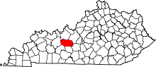
 Kentucky's location in the U.S. | |
| Founded | 1810 |
| Named for | William Grayson |
| Seat | Leitchfield |
| Largest city | Leitchfield |
| Area | |
| • Total | 511 sq mi (1,323 km2) |
| • Land | 497 sq mi (1,287 km2) |
| • Water | 14 sq mi (36 km2), 2.8% |
| Population | |
| • (2010) | 25,746 |
| • Density | 52/sq mi (20/km²) |
| Congressional district | 2nd |
| Time zone | Central: UTC-6/-5 |
| Website |
graysoncountyclerk |
Grayson County is a county located in the U.S. state of Kentucky. As of the 2010 census, the population was 25,746.[1] Its county seat is Leitchfield.[2] The county was formed in 1810 and named for William Grayson (1740-1790), a Revolutionary War colonel and a prominent Virginia political figure. It is a prohibition or dry county, though a bill was passed on March 23, 2010 to allow limited alcohol sales in restaurants.[3]
History
Grayson County was established in 1810 from land given by Hardin and Ohio counties.[4] The county is named for William Grayson (1740-1790), a Revolutionary War colonel and U.S. Senator from Virginia.[5]
Three courthouses have been destroyed through fire; in 1864 by Confederate troops, and again in 1896 and 1936.[6]
Geography
According to the U.S. Census Bureau, the county has a total area of 511 square miles (1,320 km2), of which 497 square miles (1,290 km2) is land and 14 square miles (36 km2) (2.8%) is water.[7]
Grayson County is part of the Western Coal Fields region of Kentucky.
Grayson County is home to two large lakes, the Rough River Lake on the northern border of the county and Nolin River Lake in the south. The lakes attract many tourists and have led to the nickname "Twin Lakes" region being applied to the county as a whole.
Adjacent counties
- Breckinridge County (north)
- Hardin County (northeast/EST Border)
- Hart County (southeast)
- Edmonson County (south)
- Butler County (southwest)
- Ohio County (west)
Demographics
| Historical population | |||
|---|---|---|---|
| Census | Pop. | %± | |
| 1820 | 4,055 | — | |
| 1830 | 3,880 | −4.3% | |
| 1840 | 4,461 | 15.0% | |
| 1850 | 6,837 | 53.3% | |
| 1860 | 7,982 | 16.7% | |
| 1870 | 11,580 | 45.1% | |
| 1880 | 15,784 | 36.3% | |
| 1890 | 18,688 | 18.4% | |
| 1900 | 19,878 | 6.4% | |
| 1910 | 19,958 | 0.4% | |
| 1920 | 19,927 | −0.2% | |
| 1930 | 17,055 | −14.4% | |
| 1940 | 17,562 | 3.0% | |
| 1950 | 17,063 | −2.8% | |
| 1960 | 15,834 | −7.2% | |
| 1970 | 16,445 | 3.9% | |
| 1980 | 20,854 | 26.8% | |
| 1990 | 21,050 | 0.9% | |
| 2000 | 24,053 | 14.3% | |
| 2010 | 25,746 | 7.0% | |
| Est. 2015 | 26,221 | [8] | 1.8% |
| U.S. Decennial Census[9] 1790-1960[10] 1900-1990[11] 1990-2000[12] 2010-2013[1] | |||
As of the census[13] of 2000, there were 24,053 people, 9,596 households, and 6,966 families residing in the county. The population density was 48 per square mile (19/km2). There were 12,802 housing units at an average density of 25 per square mile (9.7/km2). The racial makeup of the county was 98.26% White, 0.50% Black or African American, 0.17% Native American, 0.14% Asian, 0.01% Pacific Islander, 0.22% from other races, and 0.71% from two or more races. 0.77% of the population were Hispanic or Latino of any race.
There were 9,596 households out of which 32.10% had children under the age of 18 living with them, 58.90% were married couples living together, 10.00% had a female householder with no husband present, and 27.40% were non-families. 24.10% of all households were made up of individuals and 10.70% had someone living alone who was 65 years of age or older. The average household size was 2.47 and the average family size was 2.91.
In the county the population was spread out with 24.40% under the age of 18, 9.00% from 18 to 24, 28.00% from 25 to 44, 24.60% from 45 to 64, and 14.00% who were 65 years of age or older. The median age was 38 years. For every 100 females there were 98.10 males. For every 100 females age 18 and over, there were 95.80 males.
The median income for a household in the county was $27,639, and the median income for a family was $33,080. Males had a median income of $27,759 versus $19,302 for females. The per capita income for the county was $14,759. About 13.90% of families and 18.10% of the population were below the poverty line, including 24.10% of those under age 18 and 15.70% of those age 65 or over.Events and attractions
Grayson County is the home of the Historic Jack Thomas House which is owned and maintained by the Grayson County Historical Society. The Jack Thomas House contains a museum dedicated to the history and families of Grayson County as well as the most extensive genealogical research library for the county. It is open Monday - Friday for tours and research. Three general meetings with guest speakers relevant to the county each year are held for the membership. They are held in March, June, and October and are always open to the public. The house is open during the Twin Lakes National Fiddlers Contest (see below), the Hometown Christmas Parade as well as other special events. The house and grounds may be rented for meetings, gatherings, and weddings. Find out more at www.graysoncokyhistsoc.org or on Facebook.
Every July, Grayson County and Leitchfield hosts the Twin Lakes National Fiddlers Contest, which brings many elite fiddlers from several states to the Town Square area. The contest is a weekend event. Also in July, the City of Leitchfield hosts the annual Freedom Festival which features music, fireworks, and a carnival. In late August and early September, Grayson County hosts the annual Grayson County Fair, which entertains locals and guests with music, a carnival, a Truck and Tractor Pull, a Demolition Derby, and ends on Labor Day with a parade through Leitchfield. In September the city of Clarkson hosts the annual Honeyfest. The Honeyfest kicks off with a parade in which the Grayson County High School Band and the Grayson County Middle School Band performs. Many floats with the main subject of bees and honey are presented and advertise the many businesses in and surrounding Grayson County. This festival celebrates the city and the contributions of Clarkson's Walter T. Kelley Beehive Factory.
In early October, the city of Caneyville holds the annual Caneyville Fair.
Also, the county is home to several attractions. In addition to the previously mentioned lakes is the historic Pine Knob Theatre, located in the community of Pine Knob. Other attractions are Calvin Ray's Live Music just west of Leitchfield, and three golf courses, including 18 hole Lafayette Golf Course in Falls of Rough.
Communities
- Big Clifty
- Caneyville
- Clarkson
- Leitchfield (county seat)
- Pine Knob
See also
References
- 1 2 "State & County QuickFacts". United States Census Bureau. Retrieved March 6, 2014.
- ↑ "Find a County". National Association of Counties. Retrieved 2011-06-07.
- ↑ "Leitchfield Passes Limited 100 Vote". Wbko.com. 2010-03-23. Retrieved 2012-02-08.
- ↑ Collins, Lewis (1877). History of Kentucky. p. 293.
- ↑ The Register of the Kentucky State Historical Society, Volume 1. Kentucky State Historical Society. 1903. p. 35.
- ↑ Hogan, Roseann Reinemuth (1992). Kentucky Ancestry: A Guide to Genealogical and Historical Research. Ancestry Publishing. p. 240. Retrieved 26 July 2013.
- ↑ "2010 Census Gazetteer Files". United States Census Bureau. August 22, 2012. Retrieved August 14, 2014.
- ↑ "County Totals Dataset: Population, Population Change and Estimated Components of Population Change: April 1, 2010 to July 1, 2015". Retrieved July 2, 2016.
- ↑ "U.S. Decennial Census". United States Census Bureau. Retrieved August 14, 2014.
- ↑ "Historical Census Browser". University of Virginia Library. Retrieved August 14, 2014.
- ↑ "Population of Counties by Decennial Census: 1900 to 1990". United States Census Bureau. Retrieved August 14, 2014.
- ↑ "Census 2000 PHC-T-4. Ranking Tables for Counties: 1990 and 2000" (PDF). United States Census Bureau. Retrieved August 14, 2014.
- ↑ "American FactFinder". United States Census Bureau. Retrieved 2008-01-31.
External links
-
 Geographic data related to Grayson County, Kentucky at OpenStreetMap
 - Cityhelp.com - A local county guide about Grayson, County Kentucky
- Grayson-County.Org - A local website that links civic organizations
- GraysonCountySchools.com The Grayson County Board of Education and school websites.
- K105/Twin Lakes Times - Grayson County's local FM radio station (FM 104.9) and daily web-based newspaper.
- The Record - A Grayson County newspaper.
- News-Gazette - A Grayson County newspaper.
- Grayson County Tourism - A Grayson County Tourism site.
- Leitchfield Tourism - A Leitchfield Tourism site.
- Grayson County Chamber - The Grayson County Chamber site.
Municipalities and communities of Grayson County, Kentucky, United States | ||
|---|---|---|
| Cities | | |
| Unincorporated communities | ||

Coordinates: 37°28′N 86°21′W / 37.46°N 86.35°W