Trigg County, Kentucky
| Trigg County, Kentucky | |
|---|---|
 The old Trigg County courthouse in Cadiz, Kentucky. It was torn down in 2008 to make way for a new courthouse, which is already completed. | |
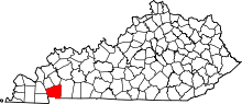 Location in the U.S. state of Kentucky | |
 Kentucky's location in the U.S. | |
| Founded | 1820 |
| Named for | Stephen Trigg |
| Seat | Cadiz |
| Largest city | Cadiz |
| Area | |
| • Total | 481 sq mi (1,246 km2) |
| • Land | 441 sq mi (1,142 km2) |
| • Water | 40 sq mi (104 km2), 8.3% |
| Population | |
| • (2010) | 14,339 |
| • Density | 32/sq mi (12/km²) |
| Congressional district | 1st |
| Time zone | Central: UTC-6/-5 |
| Website |
www |
Trigg County is a county located in the U.S. state of Kentucky. As of the 2010 census, the population was 14,339.[1] Its county seat is Cadiz.[2] It was formed in 1820 and named for Stephen Trigg, an officer in the American Revolutionary War who was killed at the Battle of Blue Licks.[3][4] Trigg was a prohibition or dry county until 2009, when the county's voters narrowly approved a referendum to repeal the prohibition on alcohol sales.[5]
Trigg County is part of the Clarksville, TN–KY Metropolitan Statistical Area.
Trigg County is governed by a Fiscal Court, which is led by a Judge-Executive. The current Judge-Executive is Hollis Alexander (D). Alexander was appointed to the position in 2013 after Stanley H. Humphries was elected to the Kentucky State Senate from District 1.
History
Trigg County was formed in 1820 from Christian County and Caldwell County.
Trigg County was named in honor of Lt. Col. Stephen Trigg, of Virginia. Lt. Col. Trigg settled near Harrodsburg, Kentucky and was killed on August 19, 1782, in the Battle of Blue Licks.[6]
Geography
According to the U.S. Census Bureau, the county has a total area of 481 square miles (1,250 km2), of which 441 square miles (1,140 km2) is land and 40 square miles (100 km2) (8.3%) is water.[7]
Adjacent counties
- Lyon County (north)
- Caldwell County (northeast)
- Christian County (east)
- Stewart County, Tennessee (south)
- Calloway County (southwest)
- Marshall County (northwest)
National protected area
Demographics
| Historical population | |||
|---|---|---|---|
| Census | Pop. | %± | |
| 1830 | 5,916 | — | |
| 1840 | 7,716 | 30.4% | |
| 1850 | 10,129 | 31.3% | |
| 1860 | 11,051 | 9.1% | |
| 1870 | 13,686 | 23.8% | |
| 1880 | 14,489 | 5.9% | |
| 1890 | 13,902 | −4.1% | |
| 1900 | 14,073 | 1.2% | |
| 1910 | 14,539 | 3.3% | |
| 1920 | 14,208 | −2.3% | |
| 1930 | 12,531 | −11.8% | |
| 1940 | 12,784 | 2.0% | |
| 1950 | 9,683 | −24.3% | |
| 1960 | 8,870 | −8.4% | |
| 1970 | 8,620 | −2.8% | |
| 1980 | 9,384 | 8.9% | |
| 1990 | 10,361 | 10.4% | |
| 2000 | 12,597 | 21.6% | |
| 2010 | 14,339 | 13.8% | |
| Est. 2015 | 14,233 | [8] | −0.7% |
| U.S. Decennial Census[9] 1790-1960[10] 1900-1990[11] 1990-2000[12] 2010-2013[1] | |||
As of the census[13] of 2000, there were 12,597 people, 5,215 households, and 3,765 families residing in the county. The population density was 28 per square mile (11/km2). There were 6,698 housing units at an average density of 15 per square mile (5.8/km2). The racial makeup of the county was 88.34% White, 9.79% Black or African American, 0.21% Native American, 0.25% Asian, 0.01% Pacific Islander, 0.18% from other races, and 1.22% from two or more races. 0.90% of the population were Hispanic or Latino of any race.
There were 5,215 households out of which 29.10% had children under the age of 18 living with them, 60.20% were married couples living together, 8.40% had a female householder with no husband present, and 27.80% were non-families. 25.00% of all households were made up of individuals and 11.60% had someone living alone who was 65 years of age or older. The average household size was 2.39 and the average family size was 2.84.
In the county the population was spread out with 22.90% under the age of 18, 6.80% from 18 to 24, 26.70% from 25 to 44, 27.00% from 45 to 64, and 16.60% who were 65 years of age or older. The median age was 40 years. For every 100 females there were 96.90 males. For every 100 females age 18 and over, there were 94.10 males.
The median income for a household in the county was $33,002, and the median income for a family was $40,886. Males had a median income of $31,158 versus $22,081 for females. The per capita income for the county was $17,184. About 8.80% of families and 12.30% of the population were below the poverty line, including 13.20% of those under age 18 and 14.70% of those age 65 or over.
Media
Radio stations
- WKDZ-FM 106.5 (country music)
- WKDZ-AM 1110 AM & 100.9 FM (oldies)
- WHVO 1480 AM & 96.5 F.M (oldies)
Newspapers
Communities
See also
References
- 1 2 "State & County QuickFacts". United States Census Bureau. Retrieved March 6, 2014.
- ↑ "Find a County". National Association of Counties. Retrieved 2011-06-07.
- ↑ The Register of the Kentucky State Historical Society, Volume 1. Kentucky State Historical Society. 1903. p. 37.
- ↑ "Trigg County". Kyenc.org. Retrieved 2013-07-10.
- ↑ http://www.cadizrecord.com/articles/stories/public/200909/30/04Ts_news.html
- ↑ Perrin, William Henry (1884). Counties of Christian and Trigg, Kentucky : historical and biographical. F.A. Battey Publishing Company. p. part II, p. 29.
- ↑ "2010 Census Gazetteer Files". United States Census Bureau. August 22, 2012. Retrieved August 20, 2014.
- ↑ "County Totals Dataset: Population, Population Change and Estimated Components of Population Change: April 1, 2010 to July 1, 2015". Retrieved July 2, 2016.
- ↑ "U.S. Decennial Census". United States Census Bureau. Retrieved August 20, 2014.
- ↑ "Historical Census Browser". University of Virginia Library. Retrieved August 20, 2014.
- ↑ "Population of Counties by Decennial Census: 1900 to 1990". United States Census Bureau. Retrieved August 20, 2014.
- ↑ "Census 2000 PHC-T-4. Ranking Tables for Counties: 1990 and 2000" (PDF). United States Census Bureau. Retrieved August 20, 2014.
- ↑ "American FactFinder". United States Census Bureau. Retrieved 2008-01-31.
External links
Municipalities and communities of Trigg County, Kentucky, United States | ||
|---|---|---|
| City | | |
| CDP | ||
| Other unincorporated community | ||
| Ghost town | ||
| Footnotes | ‡This populated place also has portions in an adjacent county or counties | |

Coordinates: 36°49′N 87°53′W / 36.81°N 87.88°W