Oakland, Kentucky
| Oakland, Kentucky | |
|---|---|
| City | |
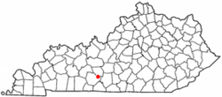 Location of Oakland, Kentucky | |
| Coordinates: 37°2′30″N 86°14′58″W / 37.04167°N 86.24944°WCoordinates: 37°2′30″N 86°14′58″W / 37.04167°N 86.24944°W | |
| Country | United States |
| State | Kentucky |
| County | Warren |
| Incorporated | 1977[1] |
| Named for | its former oak trees |
| Area | |
| • Total | 1.4 sq mi (3.6 km2) |
| • Land | 1.4 sq mi (3.6 km2) |
| • Water | 0.0 sq mi (0.0 km2) |
| Elevation | 584 ft (178 m) |
| Population (2000) | |
| • Total | 260 |
| • Density | 188.1/sq mi (72.6/km2) |
| Time zone | Central (CST) (UTC-6) |
| • Summer (DST) | CDT (UTC-5) |
| ZIP code | 42159 |
| Area code(s) | 270 |
| FIPS code | 21-57144 |
| GNIS feature ID | 0499732 |
Oakland is a 6th-class city in Warren County, Kentucky, in the United States. The population was 260 during the year 2000 U.S. Census. It is included in the Bowling Green metropolitan area.
History
In 1859, the city was named for its many oak trees by pioneer William Radford.[2]
Geography
Oakland is located at 37°2′30″N 86°14′58″W / 37.04167°N 86.24944°W (37.041675, -86.249344).[3] According to the United States Census Bureau, the city has a total area of 1.4 square miles (3.6 km2), all land.
Demographics
| Historical population | |||
|---|---|---|---|
| Census | Pop. | %± | |
| 1880 | 130 | — | |
| 1910 | 257 | — | |
| 1920 | 252 | −1.9% | |
| 1930 | 217 | −13.9% | |
| 1940 | 221 | 1.8% | |
| 1950 | 195 | −11.8% | |
| 1960 | 148 | −24.1% | |
| 1970 | 144 | −2.7% | |
| 1980 | 264 | 83.3% | |
| 1990 | 202 | −23.5% | |
| 2000 | 260 | 28.7% | |
| 2010 | 225 | −13.5% | |
| Est. 2015 | 233 | [4] | 3.6% |
As of the census[6] of 2000, there were 260 people, 102 households, and 79 families residing in the city. The population density was 188.1 people per square mile (72.7/km²). There were 107 housing units at an average density of 77.4 per square mile (29.9/km²). The racial makeup of the city was 88.08% White, 11.54% African American, and 0.38% from two or more races.
There were 102 households out of which 39.2% had children under the age of 18 living with them, 60.8% were married couples living together, 14.7% had a female householder with no husband present, and 21.6% were non-families. 18.6% of all households were made up of individuals and 6.9% had someone living alone who was 65 years of age or older. The average household size was 2.55 and the average family size was 2.88.
In the city the population was spread out with 25.8% under the age of 18, 6.5% from 18 to 24, 31.2% from 25 to 44, 26.5% from 45 to 64, and 10.0% who were 65 years of age or older. The median age was 37 years. For every 100 females there were 94.0 males. For every 100 females age 18 and over, there were 85.6 males.
The median income for a household in the city was $38,333, and the median income for a family was $45,938. Males had a median income of $28,750 versus $24,750 for females. The per capita income for the city was $14,762. About 3.7% of families and 7.9% of the population were below the poverty line, including 9.1% of those under the age of eighteen and 10.7% of those sixty five or over.
See also
- Other places named Oakland
References
- ↑ Commonwealth of Kentucky. Office of the Secretary of State. Land Office. "Oakland, Kentucky". Accessed 18 September 2013.
- ↑ "Dictionary of Places: Oakland". Encyclopedia of Kentucky. New York, New York: Somerset Publishers. 1987. ISBN 0-403-09981-1.
- ↑ "US Gazetteer files: 2010, 2000, and 1990". United States Census Bureau. 2011-02-12. Retrieved 2011-04-23.
- ↑ "Annual Estimates of the Resident Population for Incorporated Places: April 1, 2010 to July 1, 2015". Retrieved July 2, 2016.
- ↑ "Census of Population and Housing". Census.gov. Archived from the original on May 11, 2015. Retrieved June 4, 2015.
- ↑ "American FactFinder". United States Census Bureau. Archived from the original on September 11, 2013. Retrieved 2008-01-31.
Municipalities and communities of Warren County, Kentucky, United States | ||
|---|---|---|
| Cities | 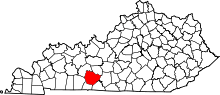 | |
| CDP | ||
| Other unincorporated communities | ||
| Principal city | _Metro.png) | |
|---|---|---|
| Other municipalities | ||
| Counties | ||
