Raceland, Kentucky
| Raceland, Kentucky | |
|---|---|
| City | |
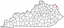 Location of Raceland, Kentucky | |
| Coordinates: 38°32′13″N 82°43′52″W / 38.53694°N 82.73111°WCoordinates: 38°32′13″N 82°43′52″W / 38.53694°N 82.73111°W | |
| Country | United States |
| State | Kentucky |
| County | Greenup |
| Established | July 31, 1915 |
| Named for | Raceland horse race track |
| Government | |
| • Type | Mayor-Council |
| • Mayor | Michael R. Wilson |
| Area | |
| • Total | 2.2 sq mi (5.7 km2) |
| • Land | 2.2 sq mi (5.7 km2) |
| • Water | 0.0 sq mi (0.0 km2) |
| Elevation | 545 ft (166 m) |
| Population (2000) | |
| • Total | 2,355 |
| • Density | 1,068.3/sq mi (412.5/km2) |
| Time zone | Eastern (EST) (UTC-5) |
| • Summer (DST) | EDT (UTC-4) |
| ZIP code | 41169 |
| Area code(s) | 606 |
| FIPS code | 21-63858 |
| GNIS feature ID | 0501513 |
Raceland is a city in Greenup County, Kentucky, United States, in the Ohio River valley. As of the 2000 census, the population was 2,355.
Raceland is a part of the Huntington-Ashland, WV-KY-OH Metropolitan Statistical Area (MSA). As of the 2000 census, the MSA had a population of 288,649.
History
The city of Raceland and the land surrounding it were part of a 5,000-acre (20 km2) Revolutionary War grant to Abraham Buford. His son, Charles Buford, divided up the land and sold it in tracts. Eventually, one of the tracts was bequeathed to Benjamen Chinn, who sold his tract in town lots. He gave the town the name Chinnville. Its first post office was established on March 7, 1910. It became an incorporated city on July 31, 1915.
In 1924, Jack O. Keene (who later established Keeneland in Lexington, Kentucky), opened Raceland Race Course near the city. Due to this, the town was renamed Raceland on April 1, 1925. The racetrack was eventually abandoned and the city was once again named Chinnville, but on April 1, 1930, the city was again named Raceland.[1]
Geography
Raceland is located at 38°32′13″N 82°43′52″W / 38.53694°N 82.73111°W (38.537003, -82.731137).[2]
According to the United States Census Bureau, the city has a total area of 2.2 square miles (5.7 km2), all land.
Demographics
| Historical population | |||
|---|---|---|---|
| Census | Pop. | %± | |
| 1930 | 1,088 | — | |
| 1940 | 1,046 | −3.9% | |
| 1950 | 1,001 | −4.3% | |
| 1960 | 1,115 | 11.4% | |
| 1970 | 1,857 | 66.5% | |
| 1980 | 1,970 | 6.1% | |
| 1990 | 2,256 | 14.5% | |
| 2000 | 2,355 | 4.4% | |
| 2010 | 2,424 | 2.9% | |
| Est. 2015 | 2,387 | [3] | −1.5% |
As of the census[5] of 2000, there were 2,355 people, 935 households, and 707 families residing in the city. The population density was 1,068.3 people per square mile (413.3/km²). There were 1,002 housing units at an average density of 454.5 per square mile (175.9/km²). The racial makeup of the city was 99.07% White, 0.47% African American, 0.04% Native American, 0.04% Asian, and 0.38% from two or more races. Hispanic or Latino of any race were 0.34% of the population.
There were 935 households out of which 33.0% had children under the age of 18 living with them, 59.6% were married couples living together, 12.8% had a female householder with no husband present, and 24.3% were non-families. 21.6% of all households were made up of individuals and 9.3% had someone living alone who was 65 years of age or older. The average household size was 2.52 and the average family size was 2.92.
In the city the population was spread out with 24.5% under the age of 18, 8.2% from 18 to 24, 29.5% from 25 to 44, 24.7% from 45 to 64, and 13.1% who were 65 years of age or older. The median age was 38 years. For every 100 females there were 91.8 males. For every 100 females age 18 and over, there were 89.1 males.
The median income for a household in the city was $31,500, and the median income for a family was $37,955. Males had a median income of $38,906 versus $19,189 for females. The per capita income for the city was $15,537. About 10.6% of families and 13.6% of the population were below the poverty line, including 18.6% of those under age 18 and 6.9% of those age 65 or over.
Economy
Transportation
Raceland is home to the Raceland Car Shop. When it was built in the 1920s, it was one of the largest railway car repair shops in the United States. The shop was built by and operated for many years by the Chesapeake and Ohio Railway and its successor company CSX Transportation and is located adjacent to CSX's Russell Classification Yard. The facility is currently owned by Progress Rail Services.[6]
Education
The city sits within the Raceland-Worthington Independent School District, which also includes the neighboring city of Worthington. Two schools, Campbell Elementary School (K-3) and Raceland-Worthington High School (7-12), are located in the city.
See also
References
- ↑ Rennick, Robert M. (1988). "Place Names". Kentucky Place Names. Lexington, Kentucky: The University Press of Kentucky. ISBN 0-8131-0179-4.
- ↑ "US Gazetteer files: 2010, 2000, and 1990". United States Census Bureau. 2011-02-12. Retrieved 2011-04-23.
- ↑ "Annual Estimates of the Resident Population for Incorporated Places: April 1, 2010 to July 1, 2015". Retrieved July 2, 2016.
- ↑ "Census of Population and Housing". Census.gov. Retrieved June 4, 2015.
- ↑ "American FactFinder". United States Census Bureau. Retrieved 2008-01-31.
- ↑ W&H MAIN YARDS: Guide to Appalachian Coal Hauling Railroads Retrieved on 2010-04-21
External links
- Chamber of Commerce
- Greenup County Tourism Commission
- Raceland-Worthington Independent School District
Municipalities and communities of Greenup County, Kentucky, United States | ||
|---|---|---|
| Cities |  | |
| Unincorporated communities | ||
| Principal cities | 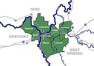 | |
|---|---|---|
| Municipalities with population over 5,000 | ||
| Municipalities with population 1,000–5,000 | ||
| Municipalities with population under 1,000 | ||
| West Virginia counties | ||
| Kentucky counties | ||
| Ohio counties | ||
